
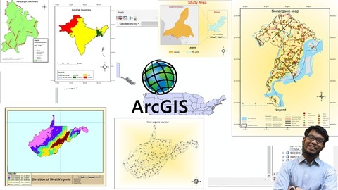
ArcGIS is a powerful geographic information system (GIS) software used by professionals in various fields, including environmental science, urban planning, and geography, to analyze and visualize spatial data.
Learning ArcGIS can equip you with the skills to create maps, perform spatial analysis, and make informed decisions based on geographic information.
This knowledge can open doors to exciting career opportunities and help you solve complex problems.
Finding the right ArcGIS course on Udemy can be overwhelming with so many options available.
You want a course that is comprehensive, engaging, and taught by experts, but also fits your learning style and goals.
You might be looking for a course that covers the fundamentals or helps you delve into advanced concepts like geoprocessing and Python scripting.
We’ve reviewed countless Udemy courses and, based on our analysis, ArcGIS Desktop For Spatial Analysis: Go From Basic To Pro is the best overall course.
This comprehensive course covers a wide range of ArcGIS Desktop functionalities, from basic data manipulation and analysis to advanced geoprocessing techniques.
You’ll learn essential skills for working with both raster and vector data, enabling you to effectively analyze and visualize spatial data.
The course also provides practical examples and exercises, solidifying your understanding and equipping you with the skills to apply ArcGIS Desktop to real-world problems.
While this is our top pick, there are many other excellent ArcGIS courses on Udemy.
Keep reading to explore our recommendations for different learning styles and goals, including courses focusing on specific ArcGIS applications, advanced techniques, and even Python integration.
ArcGIS Desktop For Spatial Analysis: Go From Basic To Pro

The course starts by introducing spatial data analysis concepts and providing access to tutorial data.
This lays the foundation for working with ArcGIS Desktop, the powerful geographic information system (GIS) software.
You’ll dive into ArcGIS Desktop’s functionality, learning how to access spatial data, make selections, zoom and measure, and handle different coordinate systems.
The course then covers working with raster data in ArcGIS, including displaying, merging, and performing band arithmetic on rasters.
You’ll also learn topographic calculations, zonal statistics, and geo-referencing rasters.
These skills are essential for analyzing elevation and terrain data.
Moving on to vector data, you’ll explore exploratory data analysis with shapefile attributes, spatial joins, creating choropleth maps, and various geoprocessing tasks like clipping, intersecting, and buffering shapefiles.
This section equips you with the tools to analyze and manipulate vector spatial data effectively.
The course also delves into advanced geoprocessing tasks like euclidean distance raster generation, density analysis, interpolation, and mapping spatial clusters.
You’ll even learn about geographically weighted regression, a powerful statistical technique for spatial analysis.
To streamline your workflows, you’ll learn how to use Model Builder in ArcGIS to automate geoprocessing tasks.
This can save you significant time and effort when working with large datasets.
Finally, the course covers map making in ArcGIS, teaching you how to present spatial data effectively using layers, basemaps, and cartographic design principles.
You’ll be able to create professional-looking maps that communicate your analysis results clearly.
ArcPy for Python Developers using ArcGIS Pro

This course will equip you with the skills to unlock the full potential of ArcGIS Pro through the power of ArcPy, Python’s robust GIS library.
You’ll be able to automate your workflows, perform complex analysis, and create stunning maps with unparalleled efficiency.
You’ll start by mastering the fundamentals of ArcPy, ArcGIS Pro, and spatial data.
You’ll learn how to write basic Python scripts and leverage the Python window to interact with ArcGIS Pro directly.
But this is just the beginning.
Prepare to delve deeper into the intricacies of geoprocessing.
You’ll master environmental settings, enabling you to control workspace, output locations, and other crucial aspects of your projects.
You’ll learn how to wield the power of ModelBuilder to construct complex workflows, then seamlessly integrate Python scripts for ultimate control.
The course dives into the hands-on world of data manipulation.
You’ll learn how to access and modify data in feature classes, effortlessly creating and manipulating geometry objects.
You’ll master cursors for data editing, explore the advanced data access module (arcpy.da), and gain proficiency in performing calculations with spatial data.
The power of visualization is at your fingertips with the mapping module (arcpy.mp).
You’ll learn to programmatically create and customize maps in ArcGIS Pro, adding text, graphics, pictures, and map surrounds to achieve stunning visual impact.
You’ll discover how to craft dynamic maps and map series, harnessing bookmarks to effortlessly create PDF map books.
The course will teach you how to leverage the Cartographic Information Model (CIM) to fine-tune the symbology of your maps, giving you precise control over the visual representation of your data.
You’ll have a solid foundation to build upon, ready to explore the boundless possibilities of ArcPy and Python development within the ArcGIS Pro environment.
Basics of Python & arcpy , the Python library of ESRI ArcGIS

This course offers a solid foundation for those seeking to automate tasks in ArcGIS using Python.
You’ll gain a practical understanding of Python fundamentals, covering essential concepts like variables, data types, conditional statements, loops, and functions.
The course also introduces object-oriented programming (OOP), a powerful tool for creating reusable code structures.
You’ll delve into the intricacies of ESRI’s arcpy package, the bridge between Python and ArcGIS.
The course carefully explains the structure of arcpy, highlighting its integration with ArcObjects.
You’ll learn to work with CSV files, a common method for importing data into ArcGIS.
The course focuses on the MapDocument class, representing a map in ArcGIS.
You’ll gain the ability to add and manipulate layers within maps, and utilize arcpy tools for various spatial analysis tasks.
While the course provides a strong introduction to Python and arcpy for ArcGIS automation, keep in mind that it’s primarily a beginner-level course.
If you have prior experience with Python or ArcGIS, you might find some sections too basic.
However, the practical examples and exercises offer valuable hands-on experience for those new to the concepts.
You’ll acquire the skills to streamline your geospatial analysis workflow, saving time and effort in your projects.
ArcGIS: From Beginner To Pro
You’ll dive into core concepts like geodatabases, shapefiles, and geoprocessing, gaining hands-on experience with the ArcMap interface.
The course starts with the basics, guiding you through the fundamentals of ArcGIS and its tools.
You’ll learn to navigate the software, understand coordinate systems, and manipulate data through selections, zooming, and basic editing.
This foundation is crucial for mastering more complex tasks later in the course.
As you progress, you’ll explore advanced geoprocessing techniques like merging, dissolving, splitting, and clipping shapefiles.
You’ll also learn how to utilize tools like buffers and intersections for creating new spatial data, enhancing your analytical capabilities.
ArcCatalog, a key tool for managing and organizing your data, is also covered in detail.
You’ll become proficient in working with shapefiles, creating custom maps, and incorporating elements like legends and basemaps for visually appealing presentations.
The course even delves into working with raster files, introducing you to the fundamentals of image analysis.
You’ll learn to classify and reclassify raster data, create slope, hill shade, and contour maps, and develop a deeper understanding of spatial data visualization.
While the course provides a strong introduction, remember that ongoing practice and exploration are key to mastering the software and its advanced functionalities.
ArcGIS Level 1: GIS & ArcMap, ArcCatalog, ArcGlobe, ArcScene
This ArcGIS Level 1 course provides a solid foundation in the fundamentals of Geographic Information Systems (GIS) and the widely used ArcGIS software.
You’ll start by gaining a strong understanding of GIS principles, including the various data formats used, particularly the ubiquitous shapefile.
The course then dives into the practicalities of ArcGIS, beginning with ArcCatalog.
You’ll learn how to manage geospatial data, create connections to folders, and understand the structure of the Catalog Tree.
Moving onto ArcMap, the core of ArcGIS, you’ll get hands-on with data manipulation.
You’ll learn to add data, create layers, and explore a range of symbolization techniques, including graduated colors and proportional symbols, to effectively visualize patterns and trends within your data.
The course doesn’t stop at data visualization.
You’ll also learn map digitizing techniques, georeferencing methods, and the crucial process of adding attributes to features.
You’ll master the creation of professional-looking map layouts, complete with legends, scale bars, and north arrows.
Geoprocessing, an essential aspect of GIS analysis, will be introduced, with exercises covering fundamental operations like creating buffers, clipping features, and merging datasets.
The course then touches on raster data, essential for working with satellite imagery and other pixel-based data.
Finally, you’ll explore ArcGlobe, which allows you to visualize your data in three dimensions.
You’ll learn how to add basemaps, vector layers, and even apply special effects to create impressive 3D representations of your data.
It’s particularly well-suited for those interested in fields like environmental science, urban planning, or geography, and will equip you with valuable practical skills that are highly sought-after in a range of industries.
ArcSWAT Model with ArcGIS - Run for any Study Area - GIS

You’ll start with the basics, learning how to download and install the necessary software, including SWAT and ArcGIS.
The course then dives into the crucial step of data preparation, guiding you through gathering and processing various datasets: climate data, soil data, digital elevation models (DEMs), and more.
You’ll learn techniques for working with data from different regions, including India and global datasets.
The course introduces R and R Studio, providing you with the tools and knowledge to manage weather data effectively.
You’ll learn how to download, format, and handle missing data values, ensuring your data is ready for analysis.
Once you’ve prepared your data, you’ll move on to building your ArcSWAT model.
You’ll learn how to define your watershed, sub-watersheds, and land use, and understand the importance of delineating Hydrologic Response Units (HRUs) within your watershed.
Setting up weather stations and running simulations is explained in detail.
The course then guides you through interpreting the results, analyzing key outputs like discharge, groundwater recharge, and curve number.
A key aspect of the course is manual calibration.
You’ll learn how to adjust model parameters, such as the curve number, to improve the accuracy of your simulations.
This hands-on experience allows you to gain a deeper understanding of the model’s capabilities and limitations.
It offers a clear path from data preparation to model calibration and analysis, equipping you with the knowledge and skills needed to confidently analyze water resources in diverse environments.
Land use Land cover classification GIS, ERDAS, ArcGIS, ML

This course equips you with the essential skills to delve into the world of land use and land cover classification using powerful GIS tools like ArcGIS and Erdas, along with modern machine learning techniques.
You’ll begin by mastering the art of downloading and processing satellite imagery, learning to work with different bands and enhance image quality for optimal analysis.
The course then guides you through the fundamental concepts of supervised and unsupervised classification.
You’ll learn to create accurate training samples and analyze classification errors, ensuring the reliability of your results.
Prepare to dive deeper into advanced techniques like combined classification and machine learning, utilizing tools like SVM and Random Forest to perform sophisticated analysis.
You’ll also gain expertise in conducting comprehensive accuracy assessments, guaranteeing the validity of your land use maps.
Beyond the theoretical aspects, you’ll engage in practical tasks in both ArcGIS and ENVI, gaining hands-on experience with real-world applications.
The course even incorporates the use of Google Earth Pro, providing you with visual tools to enhance your understanding and analysis.
By mastering the knowledge and skills acquired in this course, you’ll be well-equipped to create detailed land use maps, analyze changes over time, and make informed decisions about land management.
Exploring Spatial Information using ArcGIS Pro
This ArcGIS Pro course offers a robust introduction to working with spatial data, guiding you through the process of creating maps, analyzing information, and even exploring the world in 3D.
You’ll begin by mastering the fundamentals of ArcGIS Pro, including project creation, navigating the user interface, and utilizing the Ribbon and Contents Pane.
You’ll also learn how to download and use Natural Earth shapefiles, providing you with readily accessible datasets to build your maps.
The course dives deep into 2D map creation, teaching you how to add, remove, and reorder layers, customize basemaps, and identify features using pop-ups.
You’ll explore the Measure Tool and Snapping, which allow you to make precise measurements on your maps, adding to their accuracy and precision.
You’ll discover how to symbolize layers using unique values, graduated colors, and even attribute-driven color, techniques that enable you to create visually engaging and informative maps.
Moving beyond 2D, the course guides you through creating 3D scenes using ArcGIS Pro.
You’ll learn how to construct Global Scenes and Local Scenes, utilizing the Navigator to explore your 3D creations.
You’ll also learn to convert and link map and scene views, adding flexibility to your workflow.
The Camera Properties will allow you to adjust the perspective of your 3D scene, offering a multitude of visual options.
You’ll discover how to set Map Properties, customizing the appearance of your maps and setting the coordinate system, ensuring consistency and accuracy in your work.
This course provides a comprehensive foundation in ArcGIS Pro, covering essential concepts and skills for anyone working with spatial data.
You’ll gain the ability to effectively use the software to visualize, analyze, and share geographic information, opening up a world of possibilities for your work and exploration.