Geographic Information Systems (GIS) are powerful tools for understanding and analyzing our world.
They allow us to visualize, manage, and interpret spatial data, revealing patterns and insights that would otherwise remain hidden.
By learning GIS, you can gain valuable skills applicable to diverse fields like urban planning, environmental management, public health, and disaster response.
Whether you’re a researcher, a professional, or simply a curious individual, mastering GIS can empower you to make informed decisions and contribute to solving real-world problems.
Finding a high-quality GIS course that provides a solid foundation and equips you with practical skills can be challenging.
You’re looking for a course that combines theoretical concepts with hands-on exercises, taught by experienced instructors who can guide you through the intricacies of GIS software and spatial analysis techniques.
Based on our research, An introduction to GIS and QGIS 3 stands out as the best GIS course overall.
This Udemy course offers a comprehensive introduction to GIS principles and the widely used QGIS 3 software.
It covers essential topics like data types, spatial analysis, map creation, and data visualization, providing a strong foundation for beginners and a valuable refresher for those with some GIS experience.
While An introduction to GIS and QGIS 3 is our top recommendation, we’ve explored a range of other excellent GIS courses catering to various learning styles and interests.
Whether you’re interested in specific software like ArcGIS or specialized applications like environmental analysis, we have options for you.
Keep reading to discover more recommendations and find the perfect GIS course to embark on your spatial learning journey.
An introduction to GIS and QGIS 3

Provider: Udemy
This course teaches you the basics of Geographic Information Systems (GIS) using QGIS 3 software.
You will start with fundamentals, like understanding the difference between raster and vector data.
You will then explore QGIS, learning to open projects, navigate layers, and use map tips for information retrieval.
The course teaches you how to query data using SQL, a powerful tool for geographic analysis.
You learn to write queries to select specific attributes, allowing you to find precise information within datasets.
You will then discover how to create visually appealing thematic maps, also known as choropleth maps, to represent data effectively.
You will learn to classify data and use symbology to communicate information clearly.
Finally, you will gain hands-on experience with print layout in QGIS, learning how to export your maps as PDFs and images.
This skill is essential for sharing your work and presenting your findings.
The course provides a strong foundation in GIS and equips you with practical skills to use QGIS for various mapping and spatial analysis tasks.
Geographic Information Systems (GIS) Specialization
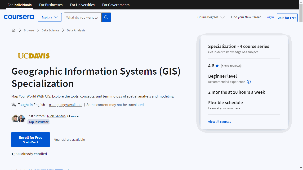
Provider: Coursera
This specialization on Coursera provides a comprehensive introduction to Geographic Information Systems (GIS).
You will learn how to use ArcGIS, a powerful industry-standard software, for spatial analysis and creating maps.
You will start with the basics, like installing the software, navigating its interface, and understanding core geospatial concepts.
You will quickly progress to creating your first maps and performing spatial analysis.
As you delve deeper into the specialization, you will explore different types of data used in GIS, such as vector and raster data.
You will learn to create, manage, and store this data effectively, understanding the nuances of geodatabases and shapefiles.
You will also acquire skills in digitizing data, writing queries, and working with rasters to analyze real-world scenarios like slope and distance.
The specialization then guides you through applying your knowledge to real-world problems.
You will work on a project from conception to analysis, learning to represent spatial data, conduct network analysis, and utilize heatmaps and hotspot analysis.
You will learn to leverage ArcGIS Pro’s advanced tools for data storytelling, visually presenting your analysis findings.
Finally, you will discover how GIS is applied in various fields like environmental studies, public health, and business development.
You will explore how GIS addresses specific industry needs, using advanced geoprocessing tools in ArcGIS Pro to tackle real-world challenges.
You will emerge from this specialization equipped with the skills and knowledge to analyze spatial data, create compelling maps, and apply GIS in diverse professional settings.
Core Spatial Data Analysis: Introductory GIS with R and QGIS
Provider: Udemy
This course teaches you how to use R and QGIS, two powerful and free tools, to work with maps and analyze geographic information, like satellite imagery and elevation data.
The course starts with the basics of spatial data, including coordinate systems, which are essential for understanding locations on a map.
You’ll then learn how to work with raster data, which is like a grid of pixels representing information like temperature or elevation.
You’ll discover how to use both R and QGIS to analyze this data, calculate vegetation indices like NDVI, and even extract topographic features like slope and aspect from elevation models.
Next, you’ll dive into vector data, which uses points, lines, and polygons to represent geographic features.
You’ll learn to use R and QGIS to explore this data, visualize it, and perform important tasks like subsetting and analyzing specific areas.
The course even covers useful plugins like Lecos in QGIS, which helps with landscape ecology analysis.
GIS, Mapping, and Spatial Analysis Specialization
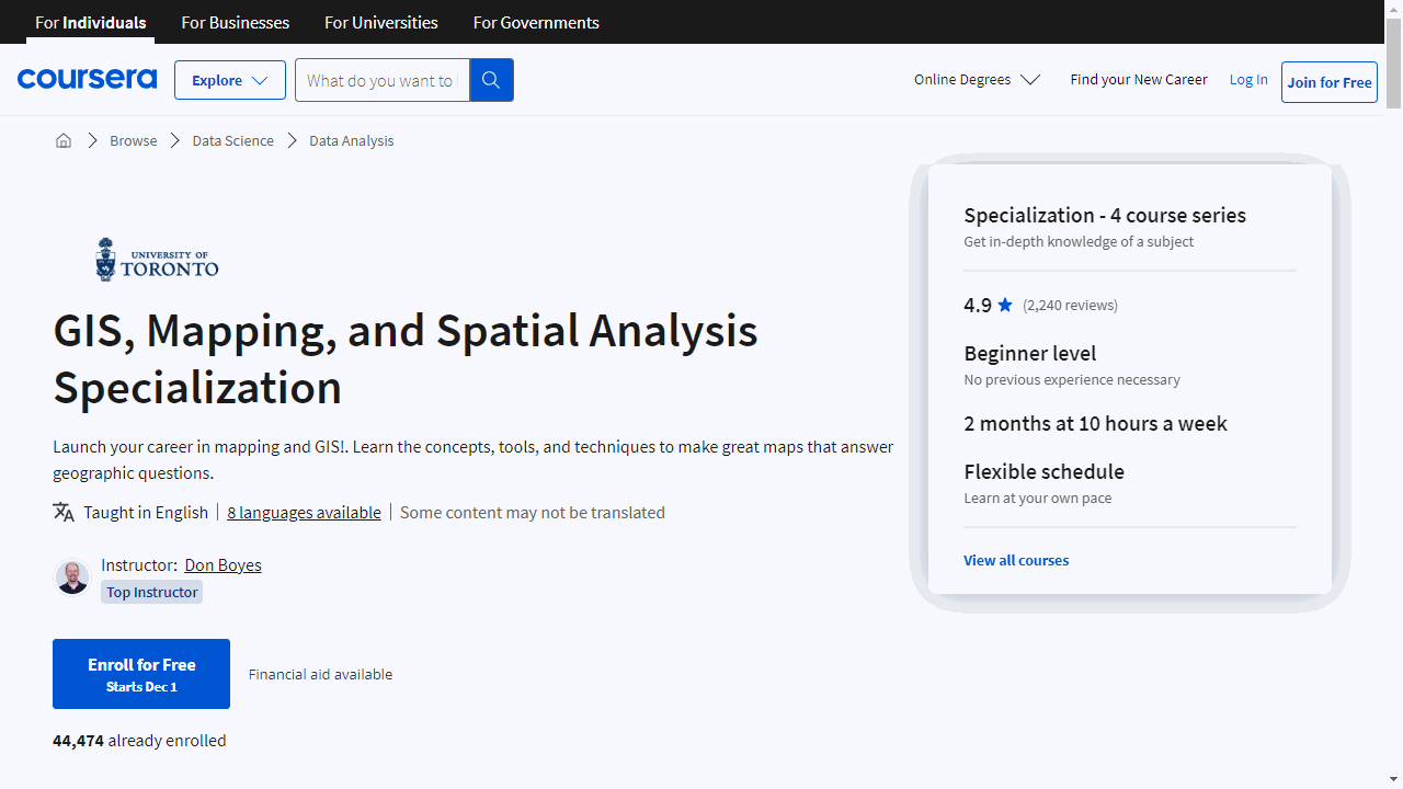
Provider: Coursera
This specialization is a great way to learn about Geographic Information Systems (GIS) and spatial analysis, even if you’re starting from scratch.
You’ll begin with the fundamentals, discovering what GIS is and how to use software like ArcGIS Desktop to create maps and analyze data.
You’ll learn about coordinates, map projections, and how to represent real-world features on a map.
You’ll even get to create your own GIS data by tracing geographic features from a satellite image, which will give you a solid understanding of how GIS data is created and used.
Next, you’ll explore how to find and use GIS data for your own projects.
You’ll learn about different types of GIS files, how to evaluate their quality using metadata, and techniques for preparing data for analysis.
You’ll learn how to merge and clip files, and even convert non-GIS data, such as addresses, into mappable data using a process called geocoding.
Additionally, you’ll discover how to design visually effective maps that clearly communicate your message, using cartographic principles to ensure your maps are both informative and visually appealing.
You’ll then dive into the exciting world of spatial analysis, learning how to use different data types and methods to answer geographic questions.
You’ll discover how to filter data sets using queries, explore spatial relationships within and between datasets, and learn how to use ModelBuilder to create analysis flowcharts.
The course also covers remotely sensed data, such as satellite imagery, which provides a wealth of information for GIS applications.
You’ll learn how to find, understand, and analyze raster data, a common data type for satellite imagery, gaining valuable skills for working with this type of data.
Finally, you’ll put all your new skills to the test by designing and completing your own GIS project from start to finish.
You’ll choose a topic and location that interests you, find relevant data, perform spatial analysis, and create informative maps using the tools and techniques you’ve learned.
Your final project will be presented as an Esri Story Map, an interactive web-based platform that allows you to share your findings with others.
This capstone project will provide you with valuable experience in applying your GIS skills to a real-world scenario.
ArcGIS Desktop For Spatial Analysis: Go From Basic To Pro

Provider: Udemy
The course guides you from the fundamentals of spatial data and GIS to using ArcGIS Desktop like an expert.
You begin by grasping the basics of GIS and mapping, learning how spatial data translates into visual information.
You quickly learn how to navigate ArcGIS Desktop, a powerful tool for handling geographic data.
The course dives into raster data, showing you how to visualize, process, and analyze this data like a pro.
You’ll master techniques like merging, reclassifying, resampling, and even calculating topographic features using rasters.
You then move on to vector data, which represents geographic features as points, lines, and polygons.
The course teaches you how to explore, analyze, and process vector data in ArcGIS Desktop, covering tasks like spatial joins, creating insightful maps, and manipulating shapefiles with operations like splitting, clipping, and intersecting.
The course then challenges you with advanced geoprocessing techniques, diving into geostatistics.
You’ll learn methods like Euclidean distance raster generation, density analysis with techniques like kernel density estimation, interpolation, and even geographically weighted regression.
You’ll discover how to automate your geoprocessing workflow using ArcGIS Model Builder.
The course wraps up by teaching you how to present your hard-earned results effectively.
You’ll learn how to create simple yet powerful maps in ArcGIS Desktop using base maps, adding layers, and skillfully organizing map elements.
You’ll be creating professional-looking maps to visualize your spatial analysis findings in no time.
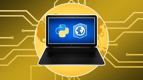
Getting Started with CyberGIS
Provider: Coursera
This course equips you with the knowledge and skills to analyze and visualize geospatial data like a pro using Python libraries.
You’ll build a strong foundation in Geographic Information Science and Systems (GIS) and understand its role in analyzing geospatial data, including massive datasets known as Big Data.
You’ll also explore cyberinfrastructure and its significance in supporting GIS applications.
The course guides you through four modules, each focusing on a different aspect of CyberGIS.
You’ll begin by diving into Python libraries like Matplotlib and Cartopy, learning how to create stunning visualizations and maps from geospatial data.
You’ll harness the power of Geopandas and Shapely to effortlessly work with vector data.
The world of Hadoop, a platform for distributed data processing, is unlocked in Module 2.
Here, you’ll grasp the concepts of the Hadoop Distributed File System and the MapReduce paradigm, essential for managing and processing large datasets.
You’ll even delve into the Hadoop Streaming API, allowing you to seamlessly integrate Python into your Hadoop workflows.
Module 3 takes you deeper into the theoretical foundations of CyberGIS and its real-world applications across various scientific domains.
You’ll explore compelling case studies and discuss future trends in this exciting field.
You’ll become proficient in Python libraries such as Folium, Mplleaflet, Basemap, and Raster.io for web mapping and raster data manipulation.
Furthermore, you’ll gain a solid understanding of Hadoop and its vital role in processing massive amounts of geospatial data.
ArcPy for Python Developers using ArcGIS Pro
Provider: Udemy
This Udemy course on “ArcPy for Python Developers using ArcGIS Pro” is perfect if you want to automate your GIS tasks.
You’ll begin by setting up your ArcGIS Pro software and the programming environment.
Then you’ll jump into using Python code to control ArcGIS Pro, from simple commands to advanced scripts that act like new ArcGIS Pro tools.
You’ll even learn to use the ArcGIS Pro documentation to find what you need about ArcPy.
Next, you will discover how to create maps, map books, and layouts.
You’ll explore real-world examples and datasets, including ones from the Natural Earth collection.
You’ll practice using Python to create map elements, like titles and legends, and learn how to automate map production, such as creating a PDF map book of all the countries in the world.
You’ll also explore advanced techniques like managing your GIS data, understanding coordinate systems like MGA, creating your own spatial data, and using powerful tools like SQL queries within ArcGIS Pro.
The course goes beyond the basics by teaching you how to customize the look of your maps, using advanced techniques like modifying symbols and accessing the Cartographic Information Model (CIM) with JSON.
Also check our posts on: