
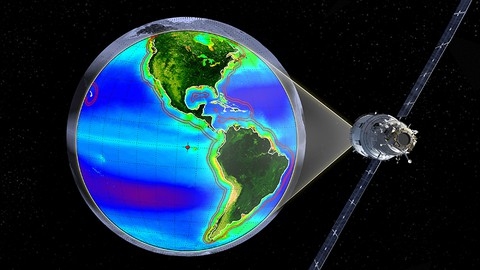
Google Earth Engine is a powerful platform for analyzing satellite imagery and geographic data.
It offers a wide range of tools and capabilities for working with remote sensing data, making it an invaluable resource for researchers, scientists, and GIS professionals.
Mastering Google Earth Engine can open up a world of possibilities for analyzing and visualizing geospatial data, from monitoring environmental changes to mapping land cover and land use.
Finding the right Google Earth Engine course on Udemy can be a daunting task, as there are so many options to choose from.
You’re looking for a course that’s both informative and engaging, taught by experienced instructors, and tailored to your specific learning goals.
For the best overall Google Earth course on Udemy, we highly recommend Complete Google Earth Engine for Remote Sensing & GIS.
This comprehensive course goes beyond the basics, diving deep into Google Earth Engine, a powerful platform for analyzing satellite imagery and geographic data.
The course teaches you how to use JavaScript to analyze data, perform GIS operations, and apply your knowledge to real-world scenarios.
While this is our top recommendation, other excellent options are available.
Keep reading to discover more Udemy courses tailored to different learning styles and levels, from beginner-friendly introductions to advanced courses focusing on specific applications of Google Earth.
Complete Google Earth Engine for Remote Sensing & GIS

This comprehensive course dives deep into the world of Google Earth Engine (GEE), a powerful platform for analyzing satellite imagery and geographic data.
You’ll start by getting acquainted with the GEE interface, exploring its vast datasets, and learning the fundamentals of coding in Javascript within the platform’s code editor.
You’ll quickly progress to essential GIS operations, mastering skills like filtering and manipulating both feature and image collections, computing zonal statistics, deriving topographic products, and performing band arithmetic on raster data.
The course covers a wide range of practical tasks, including clipping rasters, changing raster resolution, and seamlessly converting between raster and vector formats.
You’ll also learn valuable techniques for plotting and exporting data in various formats.
The course delves into real-world applications with a strong emphasis on Landsat data.
You’ll explore pre-processing techniques like atmospheric correction and pan sharpening, along with creating composites and computing texture indices.
You’ll then dive into different classification methods, including unsupervised classification using K Means Clustering and supervised classification.
Beyond imagery analysis, you’ll gain insights into working with socio-economic data, analyzing Hansen Forest Loss Data, and computing forest loss at different scales.
The course concludes with a section on object-based image analysis (OBIA), a sophisticated method for analyzing images by grouping pixels into meaningful objects.
You’ll learn how to perform OBIA in GEE, covering crucial preliminary steps like computing distance rasters.
This course offers a well-structured path from the basics of GEE to advanced applications.
You’ll gain a robust understanding of the platform’s capabilities and be well-equipped to tackle complex geospatial analyses.
Google Earth Engine Mega Course: Remote Sensing Applications
You’ll dive right in, getting your hands dirty with the fundamentals of the Earth Engine API and JavaScript.
The curriculum starts with setting up your environment and familiarizing you with the platform’s interface.
You’ll then learn about key concepts like Earth Engine objects, image collections, and feature collections, all essential for working with remote sensing data.
The course provides practical exercises to help you solidify your understanding of these concepts.
You’ll progress to advanced image processing techniques like cloud masking, spectral index calculations, reducers, and zonal statistics.
These methods are crucial for extracting meaningful insights from your data.
The course also delves into various applications of Earth Engine, including land cover classification, drought monitoring, LST analysis, and water mapping.
You’ll explore the use of machine learning for water prediction and gain practical experience analyzing air pollution data.
Beyond remote sensing, the course touches upon the technical aspects of using Google Cloud Platform.
You’ll be introduced to services like S3, EC2, and Lambda, giving you a foundation in the cloud computing environment that powers Earth Engine.
Google Earth Engine for Machine Learning & Change Detection
You’ll get hands-on experience working with Google Earth Engine, a powerful cloud-based platform for analyzing geospatial data.
The course starts by introducing you to Google Earth Engine and its code editor, where you’ll learn how to work with various datasets and perform basic image analysis tasks.
You’ll get familiar with JavaScript, the programming language used in Earth Engine, and learn how to declare variables, map and reduce collections, and visualize images.
From there, you’ll dive into machine learning concepts and their applications in GIS and remote sensing.
The course covers both supervised and unsupervised classification techniques, such as Random Forest and K-means clustering, which are essential for land use/land cover (LULC) mapping and change detection analysis.
You’ll learn the entire workflow of supervised classification, from importing and visualizing satellite imagery like Landsat data, to training machine learning models, classifying images, and assessing the accuracy of your LULC maps.
The course also introduces you to change detection techniques, including the Normalized Burn Ratio (NBR) index for mapping burn severity and time series trend analysis using linear regression.
Throughout the course, you’ll work on hands-on labs and a final project, giving you practical experience in applying the concepts you’ve learned.
The labs cover tasks like calculating NDVI, mosaicking and clipping images, exporting data, and implementing various classification algorithms in Earth Engine.
QGIS & Google Earth Engine for Environmental Applications
This course is a valuable resource for anyone seeking to master the powerful tools of QGIS and Google Earth Engine for environmental analysis.
You’ll embark on a journey that delves deep into the world of remote sensing data, equipping you to track and understand environmental changes.
The course begins by grounding you in the fundamentals of QGIS, guiding you through software installation and the intricacies of various plugins.
You’ll even explore the Trends.Earth plugin, a helpful tool for downloading and analyzing data related to land degradation.
Next, you’ll venture into the cloud-based realm of Google Earth Engine, where you’ll gain hands-on experience with JavaScript, the language that powers this platform.
You’ll learn to analyze satellite imagery, uncovering trends in land cover change, drought conditions, and even flood events.
The course doesn’t shy away from real-world applications.
You’ll learn to calculate the SDG 15.3.1 Land Degradation Indicator, a crucial metric for assessing planetary health.
You’ll also analyze MODIS data to identify drought patterns and utilize the Normalized Difference Water Index (NDWI) to monitor floods.
And if you’re interested in understanding human activity over time, you’ll explore the power of Night Lights data analysis.
This course provides you with a comprehensive toolkit, empowering you to analyze data on land cover, drought, flooding, and more, gaining deeper insights into the ever-changing environment.
Google Earth Engine for Remote Sensing & GIS: 3 courses in 1
This course provides a comprehensive and practical introduction to Google Earth Engine (GEE), a powerful platform for analyzing satellite imagery.
You’ll begin by familiarizing yourself with GEE’s interface, exploring the different types of spatial data like raster and vector data, and understanding the key differences between satellite sensors and platforms.
You’ll also delve into important programs like Landsat from NASA and Sentinel from ESA, gaining a solid foundation for working with satellite data.
Next, you’ll dive into the world of JavaScript and learn how to harness its power for geospatial analysis within GEE.
You’ll master essential techniques like mapping and reducing collections, allowing you to effectively visualize and analyze complex datasets.
The course equips you with critical practical skills such as image calculations, including the calculation of NDVI (Normalized Difference Vegetation Index) to assess vegetation health, and zonal statistics for analyzing specific areas of interest.
You’ll also learn how to seamlessly import and export data between GEE and your Google Drive, making your workflow efficient and streamlined.
Moving on, you’ll tackle advanced geospatial analysis techniques.
You’ll learn how to monitor drought by iterating functions over image collections, enabling you to analyze long-term trends and patterns.
You’ll also master cloud masking for Sentinel 2 images, effectively eliminating data gaps and ensuring accurate analysis.
The course delves into flood mapping using the Normalized Difference Water Index (NDWI) and Sentinel-2 imagery, providing you with valuable skills for analyzing and mitigating flood risks.
This knowledge culminates in a hands-on project where you’ll apply your skills to create a comprehensive flood map.
Finally, the course explores land use/land cover (LULC) classification, a crucial area in remote sensing.
You’ll gain an understanding of machine learning techniques and explore both supervised and unsupervised image classification methods using GEE.
You’ll get practical experience with supervised classification using random forest, a powerful machine learning algorithm, empowering you to create accurate land cover maps.
The course concludes with an introduction to time series trend analysis using linear regression, a powerful tool for understanding environmental changes over time.
This course provides you with the knowledge and skills to effectively leverage GEE for a wide range of geospatial analyses, from vegetation health assessments to flood mapping and land cover classification.
It’s a valuable resource for anyone seeking to apply remote sensing techniques to real-world environmental challenges.
Advanced Google Earth Engine(GEE) For Spatial Data Analysis
You’ll start by learning the basics of GEE and spatial concepts, then dive into working with various data types like imagery, shapefiles, and DEMs.
One highlight is the in-depth coverage of optical data, including Landsat and Sentinel.
You’ll learn how to process and analyze this data, compute vegetation indices, and create cloud-free composites.
The course also covers SAR data like Sentinel-1, teaching you to map flooding and work with different polarizations.
Machine learning is a key focus, with sections on both unsupervised and supervised classification using GEE.
You’ll collect training data, define classifiers, and assess accuracy metrics.
Other advanced topics include spectral unmixing, tensors, and object-based image analysis (OBIA) in GEE.
Beyond just imagery, you’ll work with socio-economic data like nightlights and explore fire patterns using MODIS data.
The course equips you with JavaScript skills for the GEE code editor and shows how to upload your own geospatial data.
With a wide range of datasets and techniques covered, from basic filtering to machine learning, this course offers a comprehensive introduction to spatial analysis in the powerful Google Earth Engine environment.
You’ll gain hands-on experience analyzing real-world data and problems.
Fundamentals of Remote Sensing with Google Earth Engine
This course provides a solid foundation in the fundamentals of remote sensing, with a particular focus on utilizing Google Earth Engine.
You’ll gain a strong understanding of the principles behind remote sensing, exploring different types of sensors and their applications in diverse fields.
The course’s real strength lies in its deep dive into Google Earth Engine, a powerful platform for analyzing vast amounts of satellite imagery.
You’ll learn how to navigate the Earth Engine API, enabling you to access and process data with ease.
The course provides a hands-on introduction to JavaScript coding, equipping you with the skills needed to manipulate and visualize imagery.
You’ll discover various data sources, including Earth Observation Satellites, and delve into the nuances of image resolution, a crucial aspect of remote sensing analysis.
The course also covers essential image processing techniques, such as compositing, mosaicking, and convolutions.
You’ll gain practical experience with tools like edge detection, resampling, and spectral transformation, which are key to extracting meaningful information from satellite imagery.
The course explores important vegetation indices like NDVI and EVI, widely used for monitoring plant health, and delves into the powerful technique of spectral unmixing to identify and quantify different materials within an image.
The final project provides a valuable opportunity to apply the skills you’ve learned in a practical setting.
The course also includes bonus lectures for those interested in exploring specific topics in greater depth.
This comprehensive approach makes this course a valuable resource for anyone seeking to learn the fundamentals of remote sensing and gain practical experience using Google Earth Engine.
Big Geospatial Data Analysis with Google Earth Engine
If you’re looking to dive deep into the world of big geospatial data analysis, this Google Earth Engine course is a great starting point.
You’ll learn to harness the power of this platform to extract valuable insights from our planet’s satellite imagery.
The course starts with the fundamentals, guiding you through the Earth Engine API and sign-up process, setting up your code editor, and introducing you to the essential JavaScript syntax needed to work with the platform.
You’ll then explore the world of big earth observation data, delving into various satellite systems like Landsat and Sentinel.
Through hands-on exercises, you’ll gain practical experience working with satellite imagery.
You’ll learn techniques to remove cloud cover from images and analyze specific data like rainfall, land surface temperature (LST), and vegetation indices (NDVI and EVI).
The course doesn’t stop there – you’ll also learn to visualize data on maps, create time series plots, and extract valuable information about monthly changes in variables like rainfall and vegetation.
This knowledge will empower you to explore our planet’s environmental changes and gain valuable insights into its complex systems.
Introduction to Google Earth Engine
You’ll begin by familiarizing yourself with the Google Earth Engine platform, setting up your account, and diving into the basics of JavaScript, the language Earth Engine uses.
You’ll quickly move on to core concepts like image visualization and analysis, learning to extract insights from image metadata.
You’ll explore mathematical operations on images, enabling you to perform calculations and derive valuable information.
The course then delves into vector data analysis, focusing on features and feature collections.
You’ll gain practical skills in visualizing these features and performing geometric operations, essential for spatial analysis tasks.
You’ll be equipped to manipulate, analyze, and visualize data to understand patterns, trends, and changes in our planet’s landscape.
Start with Google Earth Engine & Spatial Analysis #Beginners
You’ll gain a solid understanding of remote sensing, the science behind how satellites capture information about our planet.
The course dives into the world of raster data, the digital representation of satellite images, and familiarizes you with the tools and techniques for working with this type of data.
You’ll get hands-on experience using the Google Earth Engine platform itself.
You’ll learn to navigate the Code Editor and Explorer, the tools you’ll use to work with satellite data.
You’ll become comfortable with JavaScript, the programming language used in Google Earth Engine.
Throughout the course, you’ll engage in practical labs where you’ll map data, create image composites, and calculate important indices like the Normalized Difference Vegetation Index (NDVI) to measure plant health.
You’ll also explore image classification techniques, which help you identify different land cover types like forests, water bodies, and urban areas.
This course provides a strong foundation for anyone seeking to apply remote sensing techniques to environmental research or other fields.