Spatial databases are revolutionizing the way we interact with and understand geographic data.
By combining the power of databases with the intricacies of spatial information, they allow us to analyze patterns, model real-world scenarios, and make informed decisions across various fields, from urban planning and environmental management to logistics and transportation.
Learning PostGIS, a powerful spatial extension for the PostgreSQL database, equips you with the tools to manage, analyze, and visualize geospatial data, opening doors to exciting career opportunities and innovative solutions.
However, navigating the vast landscape of online courses to find the perfect PostGIS learning experience can be challenging.
You’re searching for a course that not only covers the fundamentals but also delves into advanced concepts, providing practical exercises and real-world applications.
You want a course that fits your learning style and sets you on the path to PostGIS mastery.
Based on our extensive research, the best overall PostGIS course on Udemy is Introduction to Spatial Databases with PostGIS and QGIS 3.
This comprehensive course provides a solid foundation in spatial database concepts, guiding you through the installation and utilization of PostGIS and QGIS.
You’ll learn to manage, analyze, and visualize geospatial data effectively, equipping you with the skills needed to tackle real-world challenges.
While this is our top recommendation, we understand that your specific needs and learning preferences may require a different approach.
We encourage you to keep reading, as we’ve compiled a list of other excellent PostGIS courses on Udemy, each catering to various skill levels and learning objectives.
Whether you’re a beginner or an experienced developer, you’ll find the perfect course to embark on your PostGIS journey.
Introduction to Spatial Databases with PostGIS and QGIS 3
You’ll start by learning the basics, understanding what spatial databases are, how they work, and why they’re so useful for handling geographic data.
The course then guides you through the installation of PostGIS and QGIS on your computer, two powerful tools that will become your go-to for spatial data management and analysis.
With the tools set up, you’ll learn how to load both spatial and non-spatial data into PostGIS.
The course then introduces you to SQL, the language used to communicate with databases.
You’ll master the art of writing SQL queries to retrieve, modify, and analyze data, including working with multiple tables and understanding different data types.
You’ll then explore the spatial capabilities of SQL, learning how to write queries that deal specifically with geometries like points, lines, and polygons.
The course guides you through using SQL to define your database’s structure, creating tables, establishing relationships between them, defining indexes for faster searches, and even creating your own custom data types.
You’ll become comfortable manipulating data within your database, adding new records, modifying existing ones, and deleting data.
You’ll discover how to control who has access to your database using roles and permissions.
You’ll learn to streamline your database tasks with automation techniques.
Finally, the course prepares you for the real world by teaching you how to deploy your database to a web hosting service or a cloud platform like AcuGIS Cloud.
You’ll also learn valuable techniques for optimizing the performance of your database to ensure it runs smoothly and efficiently.
Server-side web GIS applications with Leaflet and PostGIS
This course takes you from the ground up, teaching you how to build a dynamic web map application from scratch.
You’ll begin by learning how to load spatial data into a PostGIS database and display it on a Leaflet map.
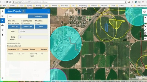
You’ll then discover how to use PostGIS to perform spatial queries, like finding all points of interest within a certain radius or identifying areas impacted by specific constraints.
The course doesn’t just stop at the basics.
You’ll dive into advanced techniques such as using PHP scripts to create GeoJSON from your PostGIS data, allowing for dynamic map updates and a more interactive user experience.
You’ll even explore how to use the Leaflet PM plugin to directly edit features on your map, adding another layer of functionality to your application.
As you progress, you’ll learn to build a polished and user-friendly web GIS application.
This includes creating a tabbed sidebar to organize different types of map content, setting up user authentication to control data access, and even implementing editing capabilities for both spatial and non-spatial data.
You’ll learn to handle multi-part geometries, allowing you to work with complex shapes, and become comfortable working with SQL queries to filter and analyze your data.
The course even covers refactoring your code for better organization and efficiency, a crucial skill for any developer.
Mobile GIS data collection apps with Leaflet and PostGIS
This course teaches you how to build mobile apps that collect geographic data.
You start by setting up the app’s structure, including the database and content management system.
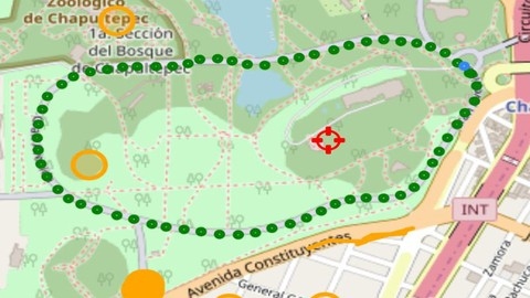
Then, you learn how to initialize a map, add interactive elements like buttons and crosshairs, and use geolocation to track the user’s location.
You even create a breadcrumb trail to visualize their movements.
You learn to build an info screen that shows location details and implement an accuracy filter to manage data quality.
The course then dives into database interaction, teaching you how to load and display different types of geographic data, like points, lines, and polygons.
You learn various techniques to collect new data, such as using screen taps, crosshairs, and GPS averaging.
The course teaches you how to make the app work offline.
You discover how to store data locally, allowing users to collect data even without an internet connection.
You then learn to synchronize these offline changes with the database, ensuring that all data is up-to-date once the user is back online.
Finally, a bonus lecture provides valuable tips on maximizing your learning from this course and others in the series.
Open Source GIS: Enterprise GIS w/ Postgres/PostGIS
This course equips you with the skills to build and manage powerful geographic information systems (GIS) using open-source tools like Postgres and PostGIS.
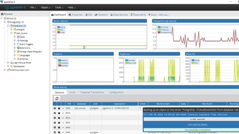
You begin by installing Postgres and QGIS, essential tools for working with geospatial data.
You then dive into importing data into your Postgres/PostGIS database, learning various techniques for efficient data management.
The course guides you through designing and implementing robust GIS systems.
You’ll discover how to define logical and physical database structures, including groups, users, layers, roles, views, constraints, and triggers.
These design principles are essential for building secure, organized, and efficient GIS solutions.
You learn how to access, edit, and analyze your data in real-world scenarios.
You discover how to work with data from desktop clients, enable simultaneous editing for multiple users, perform server-side analysis for improved performance, and even integrate Python for advanced geospatial tasks.
You also explore creating dynamic web maps with Postgres/PostGIS.
Finally, you explore cloud deployment options and receive guidance on continuing your GIS learning journey.
A Comprehensive Guide to PostGIS and Spatial Queries
This course guides you from setting up PostgreSQL and PostGIS to writing advanced spatial queries.
You will start with the basics, learning how to create databases, import tables, and perform both spatial and non-spatial queries.
You will learn essential SQL statements such as SELECT, INSERT, UPDATE, and DELETE to manage your data effectively.
The course then introduces you to spatial concepts like CRS, EPSG, and SRID, crucial for working with geographic data.
You will then dive into spatial functions, learning how to convert between different coordinate systems, create spatial tables, and import spatial data from external sources.
You will gain hands-on experience using functions like ST_Distance and ST_Intersects to analyze spatial relationships between different datasets.
The course covers various spatial analysis techniques, including spatial joins, enabling you to combine data from different tables based on location.
You will explore advanced concepts such as PostgreSQL triggers, which allow you to automate actions within your database for improved data management.
Additionally, the course covers database backup and restoration, ensuring you can safeguard your valuable spatial data.
The Complete Course of PostGIS 2024
This course takes you on a journey, from the fundamentals to the mastery of spatial databases using PostGIS.
You begin by grasping the importance of spatial data types and formats.
You then learn to install and configure PostgreSQL and PostGIS, the foundation for working with spatial data.
The course then guides you through creating your own spatial databases and tables.
You’ll master the art of spatial queries, learning to extract meaningful insights from location-based data.
You’ll become proficient in using geometric functions to calculate distances and areas, and you’ll delve into powerful spatial analysis techniques.
You’ll learn how to perform spatial joins, overlays, buffer analysis, and proximity queries, essential skills for anyone working with geospatial data.
The course doesn’t shy away from advanced topics.
You’ll explore 3D geometry and operations, unlocking new dimensions in your spatial analysis.
You’ll discover the intricacies of working with raster data, adding another layer of depth to your skillset.
You’ll also dive into network analysis and routing, opening doors to solving complex problems related to transportation and logistics.
You’ll discover the power of spatial indexing and query optimization, ensuring your spatial databases run smoothly and efficiently, even with massive datasets.
The course also bridges the gap between theory and practice by guiding you through a practical assignment, allowing you to apply your knowledge to real-world scenarios.
You’ll learn how to integrate PostGIS with industry-standard GIS software like QGIS, expanding your toolkit for spatial data management and analysis.
You’ll also explore the world of interoperability by working with different spatial data formats like Shapefile and GeoJSON.
Finally, you’ll put your knowledge to the test by completing a capstone project, where you’ll build a web mapping application using PostGIS, showcasing your mastery of spatial database concepts and their practical applications.
Learning Open Source GIS: Spatial SQL w/ Postgres/PosGIS
You’ll start by setting up the necessary software like PostgreSQL 11 and QGIS 3.8.
The course walks you through loading your data and even troubleshooting common issues.
You’ll then dive into SQL, the language used to talk to databases.
You’ll learn about different types of data, such as numbers, dates, and even spatial data types, which are specific to location information.
You’ll master traditional SQL commands, like SELECT, which retrieves data, and learn how to create new data entries and update existing ones.
The course then takes you deeper into the world of spatial SQL.
You’ll discover how to use coordinate systems and indexes within your SQL commands, opening up a whole new set of possibilities for analyzing geographic patterns.
You’ll learn a variety of spatial commands, like ST_Distance and ST_Intersects, allowing you to calculate distances between points, see if shapes overlap, and much more.
Finally, you will apply your new skills to real-world problems.
You will learn how to build geographic models, like variograms, which help understand spatial patterns.
You will explore concepts like distance, adjacency, and interaction and see how they apply to solving geographic problems.
The course culminates in a practical exercise where you’ll summarize parcel data within watersheds and flood zones, giving you a taste of how spatial SQL can be used for complex analysis.
